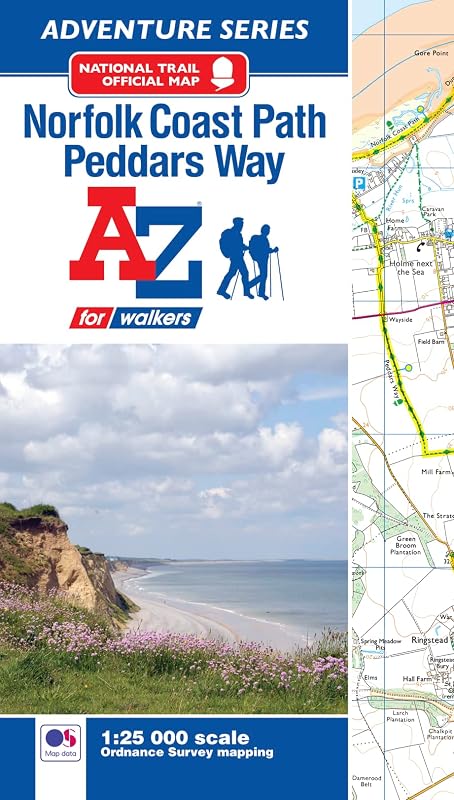
Norfolk Coast Path and Peddars Way A-Z Adventure Atlas by Geographers' A-Z Map Co Ltd

Norfolk Coast Path and Peddars Way A-Z Adventure Atlas

Geographers' A-Z Map Co Ltd
76 pages
Geographers' A-Z Map Co Ltd
Jan 2019
Paperback
All Non-Fiction WSBN
0
Readers
0
Reviews
0
Discussions
0
Quotes
The A-Z Adventure Series of maps combines the best of OS and A-Z, creating the perfect companion for walkers, off-road cyclists, horse riders and anyone wishing to explore the great outdoors.Together, the Norfolk Coast Path and Peddars Way form a 93 mile (150km) National Trail across west Norfolk and along its northern coast. Each path has its own distinctive characteristics - the directness of Peddars Way, following the course of a Roman Road, through forest, heath, open farmland and quiet river valleys contrasting with the small harbours, low cliffs, sand and saltmarsh found along the Norfolk Coast Path. Both share a rich landscape with fantastic scenery, wide open skies and an abundance of wildlife. The route on the map is clearly highlighted in yellow with mileage markers to gauge distances when planning sections of the walk to enjoy.This official National Trail Map* of Norfolk Coast Path and Peddars Way features 58 pages of continuous Ordnance Survey 1:25000 mapping, including the latest eastern extension to the Norfolk Coast Path and additional pages covering the proposed route from Hunstanton to the Lincolnshire boundary. The atlas includes a route planner showing distances between places and the amenities available, featuring:* Information Centres* Hotels/B&Bs* Youth Hostels* Campsites (seasonal opening) * Public Houses* Shops* Restaurants* Cafes (seasonal opening) * Petrol StationsAlso featured is advice on safety and security when walking and a selection of QR codes linked to useful websites, including temporary route updates from the National Trails, regional information, map reading advice and weather reports.Unlike the original OS sheets, this A-Z Adventure Atlas includes a comprehensive index to towns, villages, hamlets and locations, natural features, nature reserves, car parks and youth hostels, making it easy to find the required location quickly. Each index entry has a page reference and a six figure National Grid Reference. With a book size of 240mm x 134mm it is the same size as the standard OS folded map.Other National Trails available within the A-Z Adventure series include: Cotswold Way, Hadrian's Wall Path, North Downs Way, Pembrokeshire Coast Path, Offa's Dyke Path, Pennine Way, South Downs Way, SW Coast Path, Thames Path and The Ridgeway.*A-Z is the official mapping partner of the National Trails.
Join the conversation

No discussions yet. Join BookLovers to start a discussion about this book!

No reviews yet. Join BookLovers to write the first review!

No quotes shared yet. Join BookLovers to share your favorite quotes!

Earn Points
Your voice matters. Every comment, review, and quote earns you reward points redeemable for Bitcoin.
Comment +5 pts Review +20 pts Quote +7 pts Upvote +1 pt
BookMatch Quiz
Find books similar to this one
About this book
Pages 76
Publisher Geographers' A-Z Map...
Published 2019
Readers 0