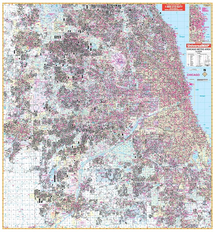
The 2009 Chicago, Illinois Metro Area Wall Map by Universal Map measures 70 x 76 (5'10 W x 6'4 H) . Provides complete street detail at a scale of 1inch = 3,520 feet, up-to-date cartography with new streets and changes, full-color, lamination, and street indexing in a separate book. Covers all of Cook and Dupage Counties and portions of Kane and Will Counties with boundaries -- North: to Barrington Hills, Wheeling, and Glencoe; South: to Joliet, New Lenox, Frankfort, and South Chicago Heights; East: to Lake Michigan including Calument City and Lynwood; West: to Aurora, Elgin, and Batavia in Kane County. . Also includes an inset map of Downtown Chicago and details airports, cemeteries, hospitals, railroads, post offices, all streets/highways, shopping centers, water features, recreational parks, mileage circles, city limits and annexations, government buildings, fire/police stations, educational facilities, golf courses/country clubs, ZIP codes/boundaries, section/township/range lines, and other points of interest. . Framing rails are included on top and bottom for easy wall mounting. Railed wall maps can be turned into pull down maps on spring rollers for an additional $30.